The following maps are free to download and print. For best print quality, change your printer orientation to horizontal.
Disclaimer The information contained in these publications is provided without any warranties or guarantees. Spokane Regional Health District is not responsible for any injuries or difficulti es you may encounter as a result of using this information. Always consult a physician before starting any new exercise program.
Full Map

Walking and Hiking in Spokane County - Full Map
Individual Maps
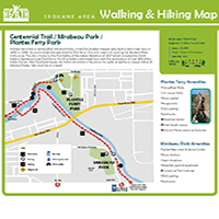
Centennial Trail - Mirabeau Park to Plantes Ferry

Cheney
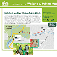
Little Spokane River - Indian Painted Rocks
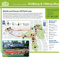
Manito Park - Cannon Hill Park Loop
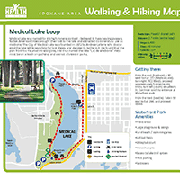
Medical Lake Loop
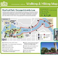
Riverfront Park - Gonzaga University Loop